images courtesy of Visual Capitalist
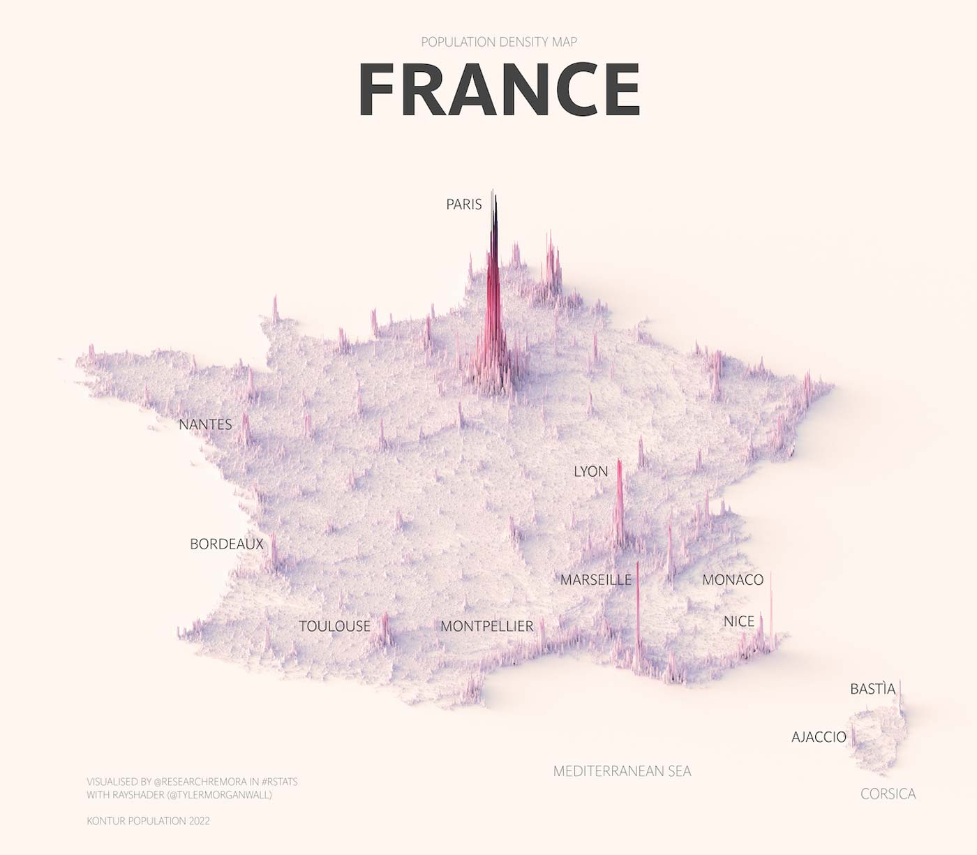
When forecasting vertical-transportation market trends, it’s essential to consider population growth — and where that growth is located. Over the last century, the global population has quadrupled. A series of maps by Seton Hall University Associate Professor Terence Teo, recently published by Visual Capitalist, make clear that this growth has not been evenly spread out. Teo’s renderings illustrate the population density of six countries using data from Kontur Population.
With the world’s seventh largest economy, France is the second-most-populous country in the European Union. Of the 65 million people who call the country home, one-fifth of the French population live in Paris and its metro area. Many Paris metro-area residents are employed in the service industry, which makes up one-third of France’s gross domestic product.

Germany has several high-density cities and regions: Berlin, Munich, Stuttgart and Cologne all have more than 1 million residents.
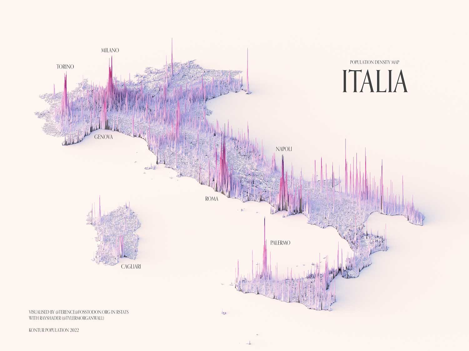
Italy’s population spikes are found closer to its sprawling coastline, as well as in its capital, Rome.

In Chile, port towns and cities have the highest density, as well. The country is more concentrated than Italy, as 40% of its residents live in and around the capital city of Santiago.
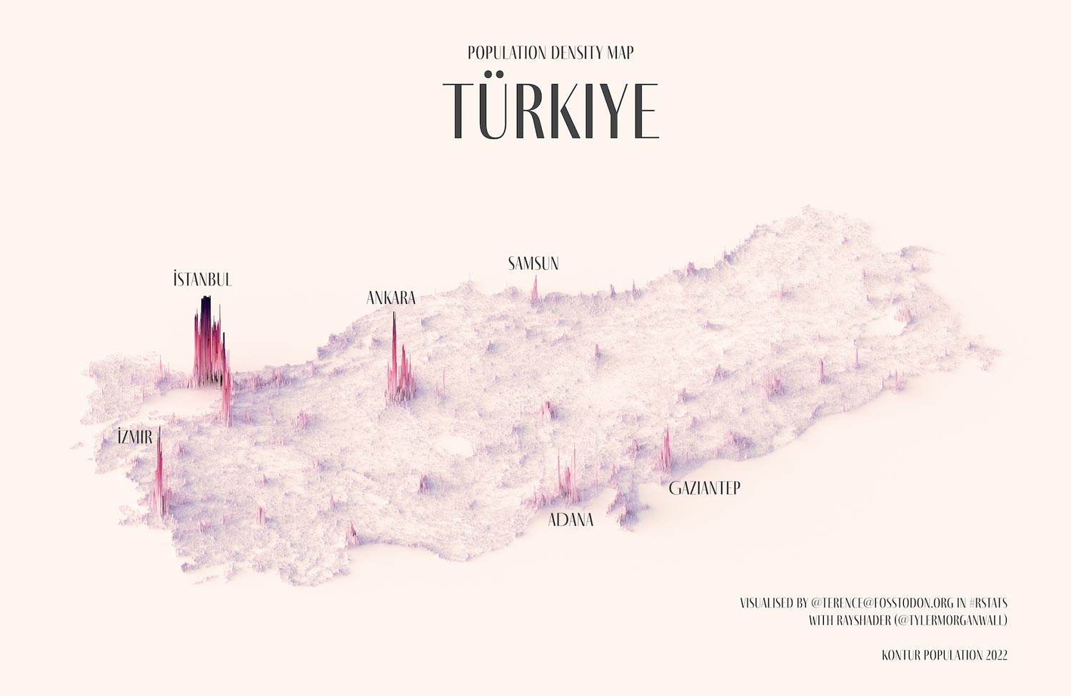
Urban growth in Türkiye is limited by mountains to the south and east, a large, semi-arid plateau and a small desert. As elevations decrease, population spikes heighten. Istanbul and Ankara are the most populous cities.
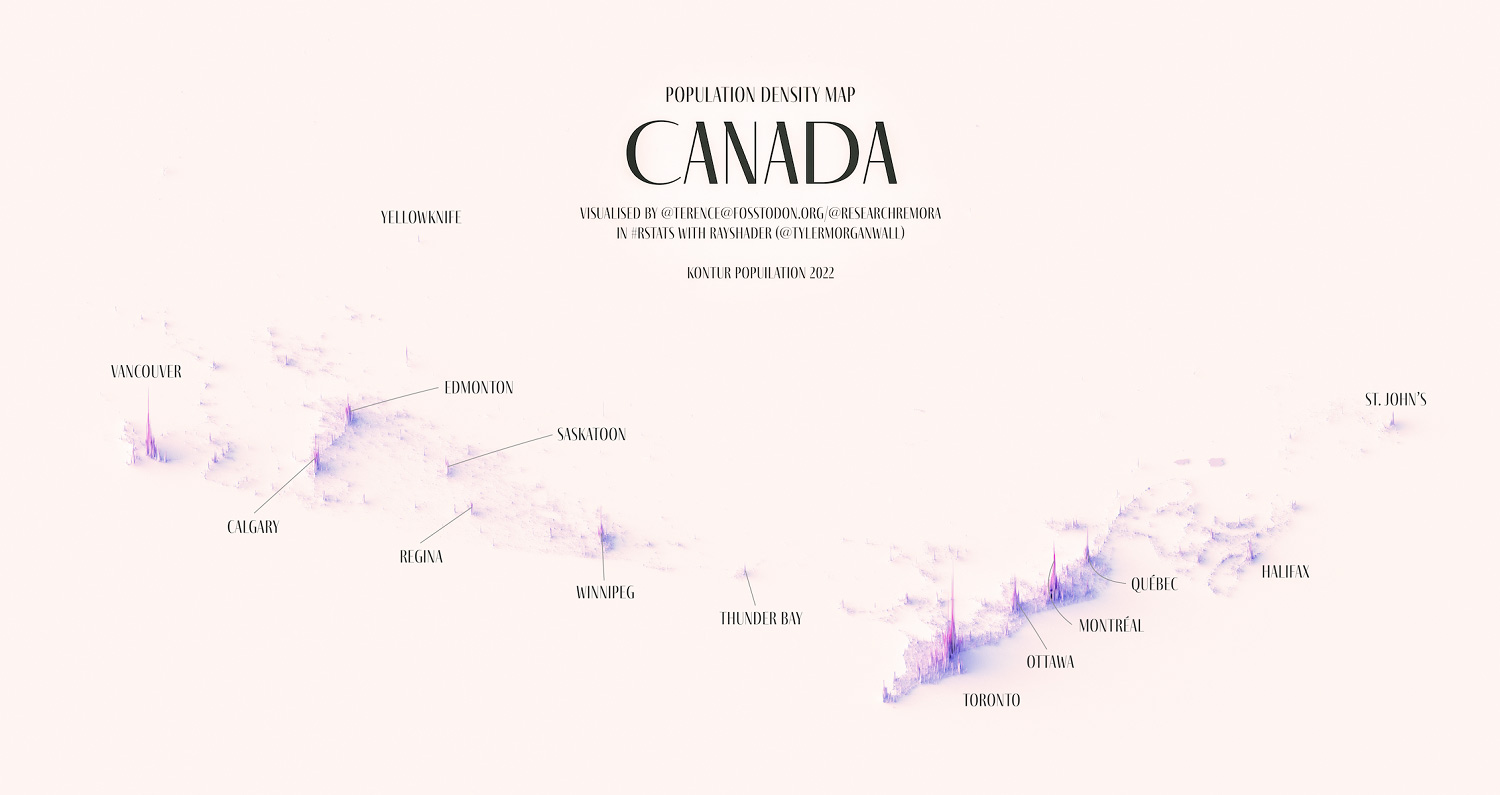
Canada’s map shows growth in the western region; however, urban centers are mostly found along the St. Lawrence River. The Greater Toronto Area accounts for more than one-sixth of the country’s population of 39 million. Freezing temperatures in Canada’s center and north and the Rocky Mountains to the west account for lower density in these areas.
The United Nations estimates that by 2050 almost 70% of the world’s population will live in urban areas. Teo’s maps demonstrate that growth is often concentrated, dependent on a particular industry or encouraged by geographical features. As urban density increases, alongside a global population expected to rise from 8 billion to 10 billion people by 2050, the best direction to go may be up.
Get more of Elevator World. Sign up for our free e-newsletter.
